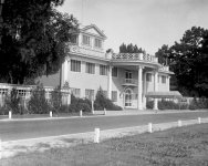
For these past few days I've been writing an article about certain inconsistencies pertaining to the state of Georgia. The piece got so big, I had to break it into individual segments.

As you can see, there is a very high probability that the PTB introduced this "Oglethorpe Plan" to explain the pre-existing advanced urban planning. The one that "colonists" had nothing to do with.
Naturally, here is what the PTB do want us to know for the state of Georgia in 1790:

KD: I think these numbers are important when we are dealing with the achievements of the "early settlers". We do need to remember that the above numbers include women, children, and elderly, as well as free and enslaved individuals. I am not sure whether indigenous people were included in these stats.

2. The City of AtlantaAs with anything else, to notice the BS, we have to know what the narrative says. The history of the founding of Atlanta appears to be simple and straight forward. But as we often see, there are these miniscule tactical maneuvers meant to convolute our clear understanding of things. We have this simple question:

I think the image above is a black and white photo of the painting. Here is a view of a photographic reproduction of an original oil painting by Wilbur Kurtz, Sr. of a bird's eye view of Atlanta, Georgia in 1864.

KD: Anyone else has doubts about the age of the presented city of (allegedly) Atlanta?

KD: Isn't it interesting that it was the date of the name change and incorporation, that was picked for the seal? In 1847, the town had already existed for 10 years. Then we have this phoenix bird. We do not think about certain things, but whether we do or not, these things exist.

I digress. The main issue to address here pertains to the event, after which the resurrection was required. We know that the town was not established in 1847, it (allegedly) happened in 1837.


In other words, distances are not that great. Now... I do think that we could be dealing with a rather large pre-existing city. In 1840 they called it Decatur. Later on certain re-adjustments of the narrative were made. The larger portion of Decatur was re-named to Atlanta, and the smaller portion on the right is still known today as the town of Decatur.
Which single star-denoted location could represents Atlanta on the map? Any single one could. At the same time all the stars represent Atlanta.

Before I bore you with additional map research, let's see what the narrative tells us about the town of Decatur.
1824

I do not think they were marking future courthouses. I think those were pre-existing cities and towns getting marked. Whether such towns/cities were conquered or found abandoned, that I have no opinion on.
Below we can see a portion of this 1854 Map of Georgia. There is our Atlanta, with rail lines arriving from four different directions. It appears that set goals were achieved, because:
And of course, the past and shenanigans go hand in hand. Here is a slightly different visual of the same area, but dated with 1853.
As we remember, the Georgia General Assembly needed a railroad hub to connect Savannah with the Midwest. For that, they drove a stake into the ground in the middle of nowhere. That middle of nowhere, with not a single building in the area in the beginning of the project, had the following names:
Question: So, how many times did we see Terminus or Marthasville? At the same time we've seen plenty of Decatur.

KD: I believe there was a reason why patent offices, archives and census data storage buildings used to burn on a regular basis. Texts are easy to forge. One would think that maps were not that different. But... what do we know? Naturally, I have no idea why these maps survived.
Here's my opinion on the Atlanta-Decatur issue:
- It does appear that we have some circumstantial evidence suggesting that many pre-existing cities and towns were incorporated into our contemporary narrative.
1. The State of Georgia
Before we can get to the actual city of Atlanta, we have to look at a few things pertaining to the state it is located in. There are a few interesting moments there, and those should not be ignored. Here is a short synopsis of how the state of Georgia came to be. The PTB tell us that before settlement by Europeans, Georgia was inhabited by Native American tribes for thousands of years.- A modest Spanish presence was established in the late 16th century, mostly centered on Catholic mission work.
- The Spanish were largely gone by the early 18th century, though they remained in nearby Florida, and their presence ultimately left little impact on what would become Georgia.
- Most Spanish place names in Georgia date from the 19th century, not from the age of colonization.
James Oglethorpe
James Edward Oglethorpe was a British soldier, Member of Parliament, and philanthropist, as well as the founder of the colony of Georgia. As a social reformer, he hoped to resettle Britain's worthy poor in the New World, initially focusing on those in debtors' prisons.- Born to a prominent British family, Othethorpe left college in England and a British Army commission to travel to France, where he attended a military academy before fighting under Prince Eugene of Savoy in the Austro-Turkish War.
- His early years were relatively undistinguished until 1729, when Oglethorpe was made chair of the Gaols Committee that investigated British debtors' prisons.
- In June 1732, Oglethorpe, Perceval, Martyn, and a group of other prominent Britons petitioned for and were eventually granted a royal charter to establish the colony of Georgia between the Savannah River and the Altamaha River.
- After being granted a charter, Oglethorpe sailed to Georgia in November 1732.
- In November 1732 a total of 114 men, women, and children gathered at Gravesend on the River Thames to set sail for the new colony of Georgia.
- Oglethorpe understood that Georgia's charter prohibited him from holding office, owning land, or receiving a salary in the new colony, yet he gave up the comforts of home to accompany the first boatload of Georgia settlers.
- After several delays they boarded the Anne for a two-month journey across the Atlantic.
- Following a brief visit in Charleston, the colonists proceeded to Port Royal, South Carolina's southernmost outpost.
- While they rested, Oglethorpe and a band of Carolina Rangers went ahead to look for a place to settle.
- Some seventeen miles inland from the mouth of the Savannah River, they found Yamacraw Bluff overlooking the south bank of the river.
- Oglethorpe immediately struck up a friendship with the Yamacraw chief, Tomochichi, thus beginning a long and close relationship between the two.
- On February 12, 1733, Oglethorpe returned to Yamacraw Bluff with the Georgia colonists.
- James Oglethorpe
- James Oglethorpe (1696-1785)
- Isn't it amazing that the father of the future state of Georgia was a knight in shining armor?
Oglethorpe Plan
This is the point, where the true researcher's BS meter should be going off the charts. The Oglethorpe plan is an urban planning idea that was most famously used when Savannah was founded in the 18th century.- The plan uses a distinctive street network with repeating squares of residential blocks, commercial blocks, and small green parks to create integrated, walkable neighborhoods.
- The multifaceted plan sought to achieve several goals through interrelated policy and design elements, including the spacing of towns, the layout of towns and eventually their surrounding counties, equitable allocation of land, and limits to growth to preserve a sustainable agrarian economy.
As you can see, there is a very high probability that the PTB introduced this "Oglethorpe Plan" to explain the pre-existing advanced urban planning. The one that "colonists" had nothing to do with.
- Looks like in this particular case, Oglethorpe could not help himself, and developed a full blown Star City.
- On February 12, 1733, Oglethorpe led 114 settlers to their arrival at Yamacraw Bluff, in what is now the city of Savannah, and established a camp with the help of a local elderly Creek chief, Tomochichi.
- A Yamacraw Indian village had occupied the site, but Oglethorpe arranged for the Indians to move.
- Today, Georgia has 100 miles of coastline. Yet, Oglethorpe had to displace Indians in one specific spot.
- Why?
Georgia Census Data
We do appear to have some population count related shenanigans. These, probably, exist for a reason. The United States Census of 1790 was the first census of the whole United States. It recorded the population of the United States as of Census Day, August 2, 1790.- Although the Census was proved statistically factual, based on data collected, the records for several states (including Delaware, Georgia, New Jersey, and Virginia) were lost sometime between 1790 and 1830.
- Almost one third of the original census data have been lost or destroyed since their original documentation.
- These include some 1790 data from: Connecticut, Maine, Maryland, Massachusetts, New Hampshire, New York, North Carolina, Pennsylvania, Rhode Island, South Carolina, and Vermont.
- However, the validity and existence of most of these data can be confirmed in many secondary sources pertaining to the first census.
Naturally, here is what the PTB do want us to know for the state of Georgia in 1790:
- Total Population: 82,548 people
- Free White Males: 27,147
- Free White Females: 25,739
- All Other Free Persons: 398
- Enslaved Persons: 29,264
- 1740: 2,021 - source
- 1750: 5,200 - source
- 1760: 9,578 - source
- 1770: 23,375 - source
- 1780: 56,071 - source
- 1790: 82,548 - source
- 1800: 162,686 - source
- 1810: 251,407 - source
- 1820: 340,989 - source
- 1830: 516,823 - source
- 1840: 691,392 - source
- 1850: 906,185 - source
- 1860: 1,057,286 - source
- 1860: In terms of geographical distribution, nearly 60 percent of the populace lived in the Black Belt region, a broad swath running diagonally through the state's center from South Carolina toward the southwest along the Alabama and Florida line.
KD: I think these numbers are important when we are dealing with the achievements of the "early settlers". We do need to remember that the above numbers include women, children, and elderly, as well as free and enslaved individuals. I am not sure whether indigenous people were included in these stats.
Georgia Counties
I'll be honest, I did not count how many counties we have in the below 1859 map. I visually compared to our contemporary county map of Georgia, and they appear to look the same. Here is my question:- What the hell did they need 159 counties for back then? Did they simply inherit the break down?
1859 Georgia Map

I wanted to see what the map progression of the establishment of Georgia counties looked like. Eventually, I stumbled into the below 1824 map.
1824: Georgia and Alabama
We have this "no man's land" between the states of Georgia and Alabama. The land was allegedly occupied by the Muscogee Indians. As the narrative goes, the Indian's were relocated:- After the Creek War, some Muscogee leaders signed treaties that ceded land to Georgia.
- The Creek War corresponded with the War of 1812 ... those little coincidences...
- Under this treaty, General Andrew Jackson forced the Creek confederacy to surrender more than 21 million acres in what is now southern Georgia and central Alabama.
- On February 12, 1825, William McIntosh and other chiefs signed the Treaty of Indian Springs, which gave up most of the remaining Creek lands in Georgia.
- Indian removal
- Indian Removal Act
1827 Georgia Map

At the time, I did not think much of it, but these "C.H." were sticking out like red flags. The explanation is in the above 1824 map, as well as further down the article.
2. The City of Atlanta
- When was the city of Atlanta founded?
- The stake marking the founding of "Terminus" was driven into the ground in 1837.
- In 1839, homes and a store were built there and the settlement grew.
- By 1842, the town had six buildings and 30 residents and was renamed Marthasville to honor Governor Wilson Lumpkin's daughter Martha.
- Between 1845 and 1854, rail lines arrived from four different directions, and the rapidly growing town quickly became the rail hub for the entire Southern United States.
- Later, J. Edgar Thomson, Chief Engineer of the Georgia Railroad, suggested the town be renamed Atlanta.
- The residents approved, and the town was incorporated as Atlanta on December 29, 1847.
- In 1864, Union William Sherman's troops set on fire and destroyed the city's assets and buildings, save churches and hospitals.
- Population of Atlanta in 1842: 30 people - source
- Population of Atlanta in 1850: 2,572 people - source
- Population of Atlanta in 1860: 9,554 people - source
- Population of Atlanta in 1870: 21,789 people - source
- 1837 - Terminus
- 1843 - Marthasville
- 1847 - Atlanta
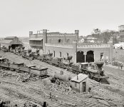
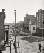
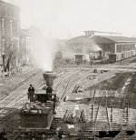
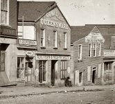
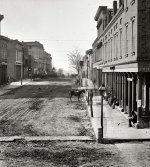
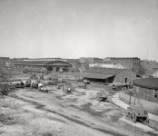
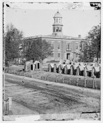
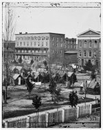
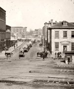
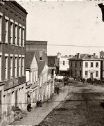
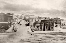
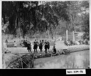
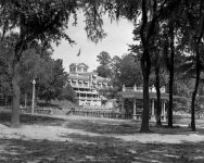
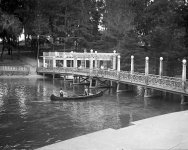
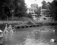
- Everything you see below is less than 25 years old.
- Photo Source #1
- Photo Source #2
- Wilbur Kurtz (1882-1967) was an avid student of local history.
- He painted scenes of early Atlanta that remain notable for the historical research that went into their creation.
- Wilbur Kurtz's depiction of 1864 Atlanta guided set design for filming "Gone With the Wind" in 1939.
I think the image above is a black and white photo of the painting. Here is a view of a photographic reproduction of an original oil painting by Wilbur Kurtz, Sr. of a bird's eye view of Atlanta, Georgia in 1864.
KD: Anyone else has doubts about the age of the presented city of (allegedly) Atlanta?
The Seal of Atlanta
The City Seal of Atlanta depicts the mythological bird, the Phoenix, who is cyclically reborn from ashes. This symbolizes the rebuilding of the city after it was burned and destroyed by war. The date depicted, 1847, is the date Atlanta was first incorporated. The date 1865 signifies the end of the Civil War and the beginning of the new Atlanta.- Resurgens is Latin for "rising again."
- Source
- In ancient Greek folklore, a phoenix is a long-lived bird that cyclically regenerates or is otherwise born again.
- Associated with the sun, a phoenix obtains new life by arising from the ashes of its predecessor.
- Some legends say it dies in a show of flames and combustion, others that it simply dies and decomposes before being born again.
I digress. The main issue to address here pertains to the event, after which the resurrection was required. We know that the town was not established in 1847, it (allegedly) happened in 1837.
- What date was the date of resurrection, 1847 or 1865?
- And if indeed it was 1847, what were they resurrecting from?
Counties: Fulton and DeKalb
Before there were two, there was one. To a certain degree, doing some research pertaining to the area represented by these two counties led me down a major rabbit hole.- The area of DeKalb County was acquired by the state of Georgia as a result of the 1821 Treaty of Indian Springs with a faction of the Muscogee (Creek).
- DeKalb County, formed in 1822 from Henry, Gwinnett and Fayette counties, took its name from Baron Johann de Kalb (1721-1780), a Bavarian-born former officer in the French Army, who fought for the Continental Army in the American Revolutionary War.
- Fulton County was created in 1853 from the western half of DeKalb County. It was named in honor of Hamilton Fulton, a railroad official who acted as surveyor for the Western and Atlantic Railroad and also as chief engineer of the state.
- As you can see in the map below, today's Decatur is located about 6 miles east of downtown Atlanta, and about 1.5 miles east of the city limits.
Which single star-denoted location could represents Atlanta on the map? Any single one could. At the same time all the stars represent Atlanta.
Decatur
Prior to European settlement, the Decatur area was largely forested. A remnant of old-growth forest near Decatur is preserved as Fernbank Forest. Decatur was established at the intersection of two Native American trails.- A site for the DeKalb County courthouse was designated in 1822 in what would become downtown Decatur.
- The city of Decatur was incorporated on December 10, 1823.
- It was named for United States Navy Commodore Stephen Decatur.
- Decatur
- C.H. - Court House
1824
1827

Question: What kind of "natural" settlements eventually becoming towns are we talking about here?
- Their biggest city in 1830 was Savannah, with barely 7,000 citizens.
- Yet, they were occupying territories and marking spots for future courthouses of yet non-existing towns?
- To me it sounds like either a conquest, or re-discovery.
Historic DeKalb Courthouse
Ok, I could not help it, for the load of BS presented to us is also a set of instructions on how to properly introduce a pre-existing building- DeKalb’s first courthouse was located in Decatur. It was built in 1823 it was described as a “crude wooden structure.”
- A replica of the first courthouse building.
- LOL.
- The next courthouse was built in 1829, and was located in the center of the square.
- On January 9, 1842, the building caught fire in the middle of the night, destroying nearly all the county’s records.
- Though the cause of the fire remains a mystery, many believe it was intentionally started by careless card players.
- In 1847, a new brick courthouse was constructed.
- It was a plain two-story red-brick building in the Greek Revival style, and had a temple front configuration supported by massive square columns.
- Although the courthouse survived the “Battle of Decatur” on July 22, 1864, it was demolished in 1898 to make room for a new courthouse.
- In 1898, a Neoclassical style courthouse replaced the modest brick building.
- Made from granite, the new structure had many new amenities, including a special room for ladies, complete with toilets.
- Images from the early 1900s show how rural the courthouse was - it is in the middle of a wide grassy lawn, atop one of the area’s highest points, and you cannot yet see any stores or businesses.
- In 1908, a Confederate monument was erected in front of the building.
- At 5:20 a.m. in September 1916, firefighters were once again called to save the county courthouse.
- Although the interior of the building was destroyed, fireproof safes protected most of the county’s records.
- The thick Lithonia granite walls withstood the flames, and they provide the foundation for the courthouse that is now the home of the DeKalb History Center.
- The cause of the fire is thought to be a smoldering cigar butt dropped by a crowd member waiting for election results the previous night.
- After the fire, the county retained what they could from the exterior of the building.
- The cupola was not rebuilt after the fire, but the two historic clocks were placed in the remaining porticoes.
- Completed in 1918, the new courthouse featured an addition of two new wings and an interior clad with Alabama marble.
- Source
- Check these out. Where are they located at, and why are they all similar?
Maps: Decatur vs. Atlanta
For our map research, it is important to remember what led to the city of Atlanta getting established. As we know, the PTB is claiming the following as the reason for the founding of the city of Atlanta:- In 1836, the Georgia General Assembly voted to build the Western and Atlantic Railroad to provide a link between the port of Savannah and the Midwest.
- A U.S. Army engineer, Colonel Stephen Harriman Long, was asked to recommend the location where the Western and Atlantic line would terminate.
- He surveyed various possible routes, then in the autumn of 1837, drove a stake into the ground between what are now Forsyth Street and Andrew Young International Boulevard, about three or four blocks northwest of today's Five Points.
- The zero milepost was later placed to mark that spot.
- In 1842, the planned terminus location was moved, four blocks southeast (two to three blocks southeast of Five Points), to what would become State Square.
- At this location, the zero milepost can now be found, adjacent to the southern entrance of Underground Atlanta.
Below we can see a portion of this 1854 Map of Georgia. There is our Atlanta, with rail lines arriving from four different directions. It appears that set goals were achieved, because:
- We can clearly see a rail line going from Atlanta towards Marietta, and from there continuing to the Midwest.
And of course, the past and shenanigans go hand in hand. Here is a slightly different visual of the same area, but dated with 1853.
As we remember, the Georgia General Assembly needed a railroad hub to connect Savannah with the Midwest. For that, they drove a stake into the ground in the middle of nowhere. That middle of nowhere, with not a single building in the area in the beginning of the project, had the following names:
- 1837-1843: Terminus
- 1843-1847: Marthasville
- 1847-present: Atlanta
- Terminus or Marthasville
Question: So, how many times did we see Terminus or Marthasville? At the same time we've seen plenty of Decatur.
- Let's see how many times this, once important city of Decatur is being mentioned in the history of Atlanta.
- Dekalb County was created in 1822, from portions of Henry, Fayette, and Gwinnett Counties, and Decatur was created as its county seat the following year.
- In 1901, the all important Atlanta and Decatur occupy the space.
- Decatur is a city which is part of the Atlanta metropolitan area.
- With a population of 19,335 in the 2010 census, the municipality is sometimes assumed to be larger since multiple ZIP Codes in unincorporated DeKalb County bear Decatur as the address.
KD: I believe there was a reason why patent offices, archives and census data storage buildings used to burn on a regular basis. Texts are easy to forge. One would think that maps were not that different. But... what do we know? Naturally, I have no idea why these maps survived.
Here's my opinion on the Atlanta-Decatur issue:
- There was a pretty large pre-existing city in the area we know today as Atlanta Metropolitan Area.
- We do not know the original name of this metropolis. May be it was the very same "Atlanta", hence the phoenix seal, who knows?
- The first repopulated area of this metropolis was originally named Decatur.
- May be because of Stephen Decatur, or some deca tour combo.
- In 1847, it was decided to name the larger western portion of the metropolis Atlanta.
- The name of Decatur was preserved by assigning it to a much smaller area on the east side of the metropolis.
- There were many other pre-existing cities and towns in the area known today as the state of Georgia
- As they were conquered or discovered by the invaders or finders, they were marked with "C.H".
- Some cities were so big, that they ended up being split into multiple smaller towns.
- I think the allegedly built railroads were pre-existing railroads getting either repaired, or unearthed.


