There are many similar definitions of what a map is. This is just one of those, "A description of the earth, or some particular part thereof, projected upon a plain superficies; describing the form of countries, rivers, situation of cities, hills, woods, and other remarks." Single maps are often included within a bundle of maps comprising a geographical atlas.
We are going to look at some very old maps. The general opinion of today's scientists is that cartographers of the past were some sort of practical jokers. Here is what National Geographic says, "Inventing cities, mountains, and monsters to fill the empty spaces on maps is a centuries-old tradition in cartography." This is very similar to how the appearance of the old maps was explained to me, when I went to school.
Obviously some of the older maps have purely decorative meaning in our today's life. Do we think that maps served decorative purposes back in the day when GPS systems were not available? I believe at the time of their creation, those maps were nothing but a useful tool upon which the lives of seafarers (and other navigators) depended. Saying obvious things is ridiculous, but maps were always used for navigation prior to the emergence of GPS. Under certain circumstances they are being used nowadays. And for that, they have to be as accurate as possible. Accuracy does not include making up lands, rivers, cities and other objects.
Yet, we are being spoon fed this non-sense about creative fantasy of the cartographers of the past. At the same time, when you look at the 16th, 17th, 18th century maps, you can't help it but notice, that continents looked very different. And our traditional scientists limited by their dogmatic teachings found an explanation. In their opinion, the smartest minds of the past were faking the world geography. My opinion is insignificant, but I disagree.
Not going to talk about the map making process itself, but if you are interested - The Cartographic Process - there you go.
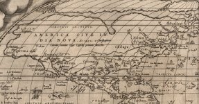
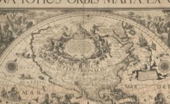
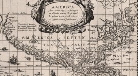
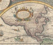
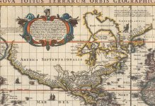
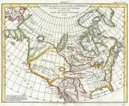
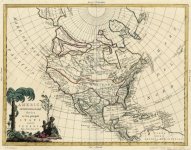
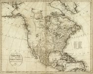
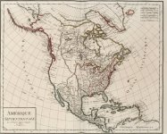
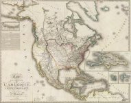
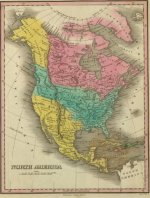
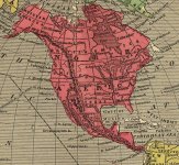
Let us take a look at how the North American continent was changing its outline with time. I just picked up a few maps pertaining to different time frames to illustrate the changes. Please notice obvious visual attributes shared by the suggested groups. It also appears there was enough time to notice a map discrepancy. Yet the maps stay consistent through out their respective time frames.
Clearly there could be a "bad apple" cartographer now and then. If there was only one person creating maps, it could be easy to fool people with false information. But as the history shows there were multiple people contributing to the creation of the maps in the past. And when you have thousands of ships sailing the world, it would not take long for the truth to come out.
This is preposterous to think that cartographers, and map makers of the past would willingly place any false information on a map.
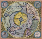
Some of the above maps are the last ones to contain Hyperborea, the circular continent you can see in the below 1595 Mercator map.

1664 - 1682 - 1700 - 1714 - 1716 - 1744
(California is an island)


1750 - 1752 - 1762 - 1762
(Mer de l'Ouest)


Note: "Mer de l'Ouest ("Western Sea"), originally the goal of exploration during the French regime, was the stuff of wishful thinking obligingly corroborated by Indians. Initially thought to be an inland sea somewhere west of the Great Lakes, it gradually blended in imagination with the Pacific." - enjoy the official version.
KD: I think there is an obvious, and consistent transition from one continental outline to the next. Sure enough, it is more convenient to explain the above transformation with the official speculative theory provided in the very beginning of this article. Personally, I doubt that cartographers of the old were making stuff up. Obviously there could be a certain degree of error, but not to the point of ridiculous re-carving of the map.
What if continents looked exactly the way they were depicted on the above maps? Could something cause the water levels to rise?
Just may be, the North American continent suffered a catastrophic event (along with the rest of the World). Map makers and Cartographers were desperately trying to reflect on the current state of things while the N. A. Continent was still changing its outline. In the 19th century the outline finally stabilized.
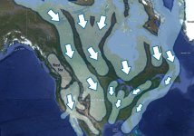
Could it be an event, or events similar in scale to ones which caused the below?
We are going to look at some very old maps. The general opinion of today's scientists is that cartographers of the past were some sort of practical jokers. Here is what National Geographic says, "Inventing cities, mountains, and monsters to fill the empty spaces on maps is a centuries-old tradition in cartography." This is very similar to how the appearance of the old maps was explained to me, when I went to school.
Obviously some of the older maps have purely decorative meaning in our today's life. Do we think that maps served decorative purposes back in the day when GPS systems were not available? I believe at the time of their creation, those maps were nothing but a useful tool upon which the lives of seafarers (and other navigators) depended. Saying obvious things is ridiculous, but maps were always used for navigation prior to the emergence of GPS. Under certain circumstances they are being used nowadays. And for that, they have to be as accurate as possible. Accuracy does not include making up lands, rivers, cities and other objects.
Yet, we are being spoon fed this non-sense about creative fantasy of the cartographers of the past. At the same time, when you look at the 16th, 17th, 18th century maps, you can't help it but notice, that continents looked very different. And our traditional scientists limited by their dogmatic teachings found an explanation. In their opinion, the smartest minds of the past were faking the world geography. My opinion is insignificant, but I disagree.
Not going to talk about the map making process itself, but if you are interested - The Cartographic Process - there you go.
Let us take a look at how the North American continent was changing its outline with time. I just picked up a few maps pertaining to different time frames to illustrate the changes. Please notice obvious visual attributes shared by the suggested groups. It also appears there was enough time to notice a map discrepancy. Yet the maps stay consistent through out their respective time frames.
Clearly there could be a "bad apple" cartographer now and then. If there was only one person creating maps, it could be easy to fool people with false information. But as the history shows there were multiple people contributing to the creation of the maps in the past. And when you have thousands of ships sailing the world, it would not take long for the truth to come out.
This is preposterous to think that cartographers, and map makers of the past would willingly place any false information on a map.
- First of all, it would not take long for one of those seafarers sent (in a flimsy wooden ship) to explore some fantasy world created by a malicious cartographer to come back. I could only imagine what a captain of some ship, who spent a couple of years at sea, would do to such a cartographer. It's not hard to understand that false maps could spell death under certain circumstances.
- And secondly, it is simply bad for business. Who would buy your maps, if they cannot be used for their only purpose?
Some of the above maps are the last ones to contain Hyperborea, the circular continent you can see in the below 1595 Mercator map.
1664 - 1682 - 1700 - 1714 - 1716 - 1744
(California is an island)
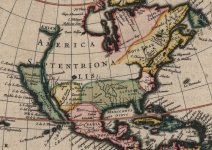
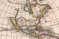
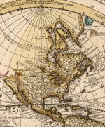
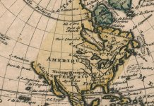
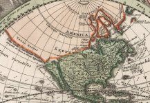
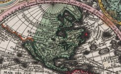
1750 - 1752 - 1762 - 1762
(Mer de l'Ouest)
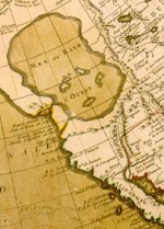
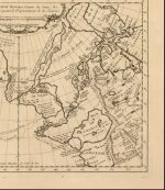
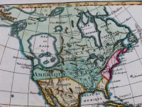
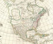
KD: I think there is an obvious, and consistent transition from one continental outline to the next. Sure enough, it is more convenient to explain the above transformation with the official speculative theory provided in the very beginning of this article. Personally, I doubt that cartographers of the old were making stuff up. Obviously there could be a certain degree of error, but not to the point of ridiculous re-carving of the map.
What if continents looked exactly the way they were depicted on the above maps? Could something cause the water levels to rise?
Just may be, the North American continent suffered a catastrophic event (along with the rest of the World). Map makers and Cartographers were desperately trying to reflect on the current state of things while the N. A. Continent was still changing its outline. In the 19th century the outline finally stabilized.
Could it be an event, or events similar in scale to ones which caused the below?


